

Kansas is often judged from a windshield, measured in interstate miles, and dismissed before the horizon has time to shift. Yet the state’s quieter roads open onto chalk canyons, inland wetlands, and tallgrass country that still moves like a sea. These places rarely sit beside major exits, so they are easy to skip and hard to forget. They hold fossil time, migration drama, ranch history, and weather carved straight into the land. Travelers who linger in these corners tend to leave with a different map in mind, one built from silence, distance, and surprise instead of speed. The reward is not spectacle, but perspective.
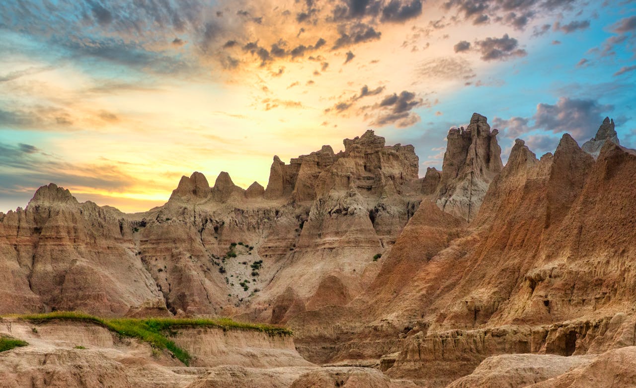
Little Jerusalem Badlands State Park
Little Jerusalem Badlands State Park in western Kansas overturns the flat-state stereotype in minutes. The site protects 332 acres of fragile Niobrara Chalk, deposited roughly 85 million years ago when a vast inland sea covered the region. White and gold spires can rise close to 100 feet, and shifting light makes the walls look different each hour.
Because the chalk breaks easily, public access is managed from designated trails and daylight hours only, helping protect rare plants and nesting birds that rely on this unusual habitat. It feels less like a roadside stop and more like a geologic archive still breathing with wind.
Monument Rocks National Natural Landmark
Monument Rocks appears suddenly out of Gove County farmland, a cluster of chalk towers and arches that looks borrowed from a desert farther west. The formations are part of the Smoky Hill Chalk and preserve fossils from ancient marine life, a reminder that Kansas once sat beneath a Cretaceous seaway. Their forms are dramatic, but the deeper draw is time made visible in layers and broken edges.
Designated a National Natural Landmark in 1968, the site remains privately owned, so respectful, low-impact visits matter. Roads can be rough after rain, and services are limited. Quiet air and evening light give the place its full force.
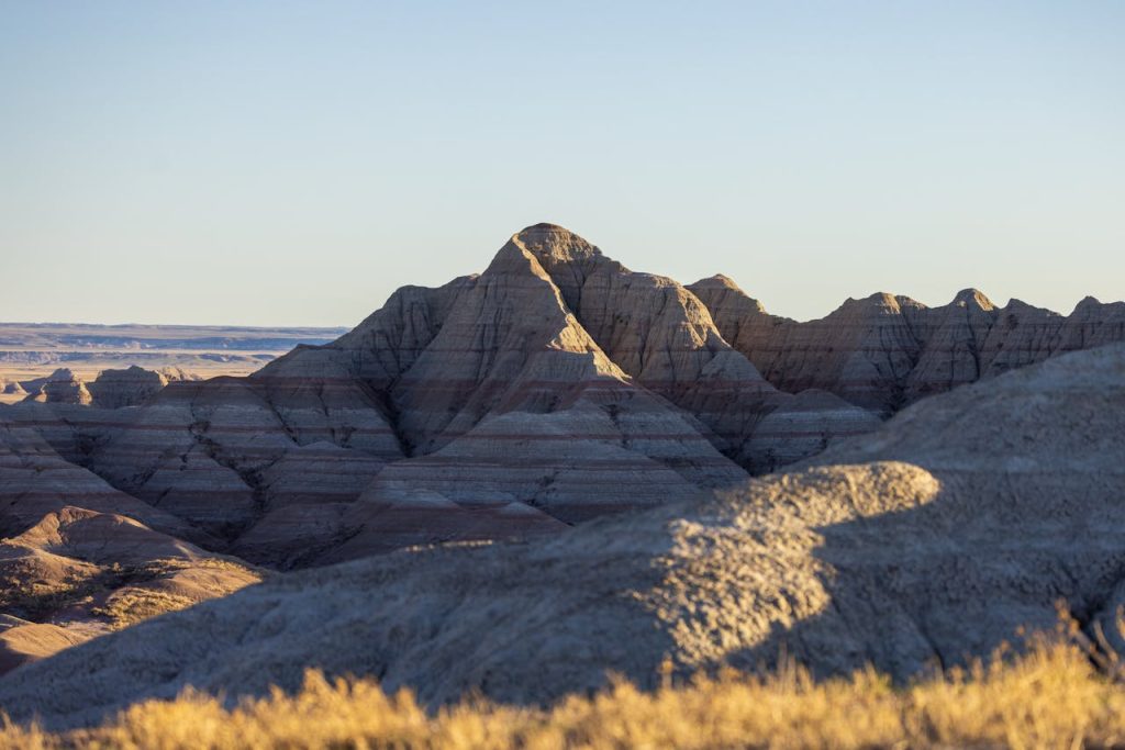
Castle Rock
Castle Rock stands apart from nearby ridges like a weathered sentinel, and the approach itself sets the tone: unpaved roads, big sky, and almost no noise except wind. The chalk butte and surrounding badlands are among western Kansas’s most striking geologic forms, shaped by erosion that never really stops. Even short walks around the base reveal how quickly texture, color, and scale shift.
Public access is allowed by a private landowner, which makes etiquette part of the experience. Wet weather can make roads difficult, so timing and local conditions matter as much as curiosity on this stop. The remoteness is part of its pull.
Cedar Bluff Reservoir
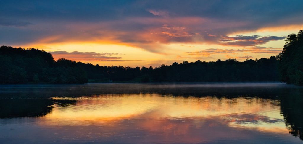
Cedar Bluff balances water, stone, and prairie in one frame. Kansas state park maps divide the area into Bluffton on the north shore and Page Creek on the south, and each side has a distinct rhythm, from busier camp loops to quieter shoreline camps. Limestone bluffs rise above the reservoir and catch late light in broad, pale bands that turn the basin cinematic.
On the water, anglers and boaters share long coves, while nearby trails and overlooks pull attention back to the terrain. Historic traces in the area add depth beyond recreation. This is the kind of place where a short pause at sunset can reset the pace of an entire trip.
Cheyenne Bottoms Wildlife Area
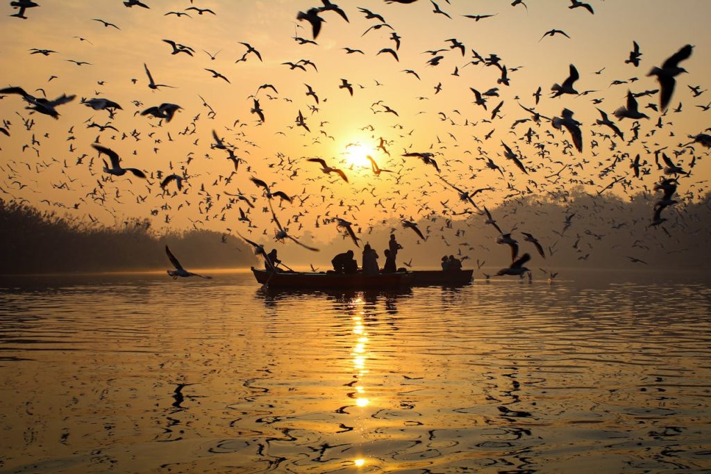
Cheyenne Bottoms, just northeast of Great Bend, is one of the most important wetland systems in the Central Flyway. The managed wildlife area covers nearly 20,000 acres and supports huge waves of migration, especially in spring and fall, when shorebirds, cranes, pelicans, ducks, and geese use the pools to rest and refuel. Even for non-birders, the scale of motion across the marsh is unforgettable.
Designations recognizing global wetland value underscore what is at stake here. Gravel dike roads and viewing pullouts make the landscape accessible while helping keep disturbance low during sensitive migration windows each season.
Lee Richardson Zoo
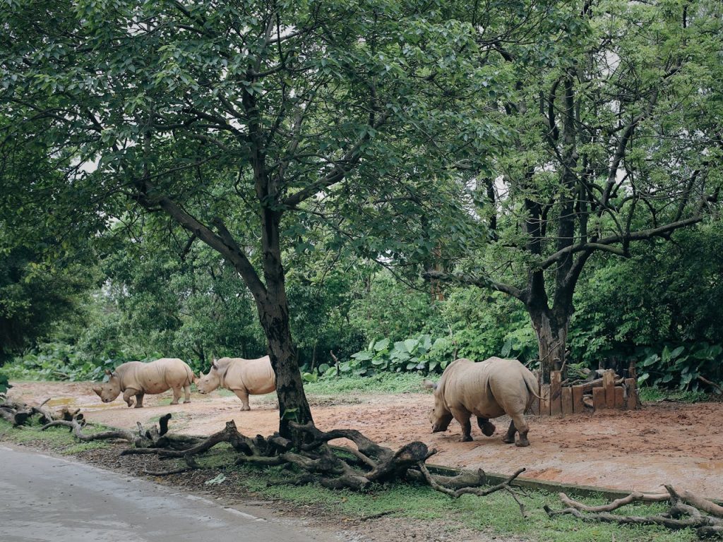
Garden City’s Lee Richardson Zoo surprises first-time visitors with both quality and scale. The zoo is AZA accredited, and current accreditation records list it through Sept. 2027, reflecting ongoing standards for animal care, conservation, and education. Landscaped grounds, broad habitats, and themed zones create a visit that feels considered rather than crowded.
What sets this stop apart on a Kansas route is flexibility: Kansas tourism information notes free walk-through access with optional paid drive-through entry. That mix makes it a practical break for families, long-distance drivers, and anyone needing a slower afternoon.
Quivira National Wildlife Refuge
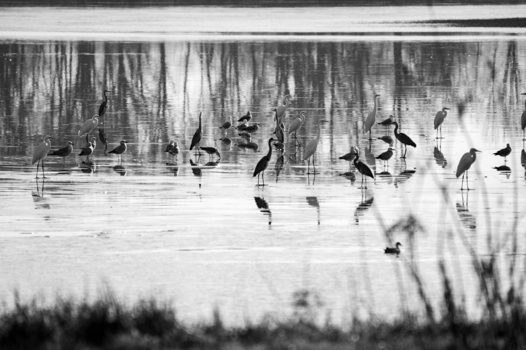
Quivira National Wildlife Refuge protects a rare inland mix of freshwater and salt marsh habitat in central Kansas. Federal refuge records list about 22,135 acres, with the Big Salt Marsh and Little Salt Marsh shaping seasonal wildlife patterns. During migration, the refuge can feel like a living map of the continent, with birds arriving in waves that connect prairie weather to distant coasts and tundra.
A slow drive through designated routes often reveals deer, raptors, and waterfowl in quick succession. In late autumn, sightings of whooping cranes draw quiet crowds and careful lenses from across the region at first light.
Maxwell Wildlife Refuge
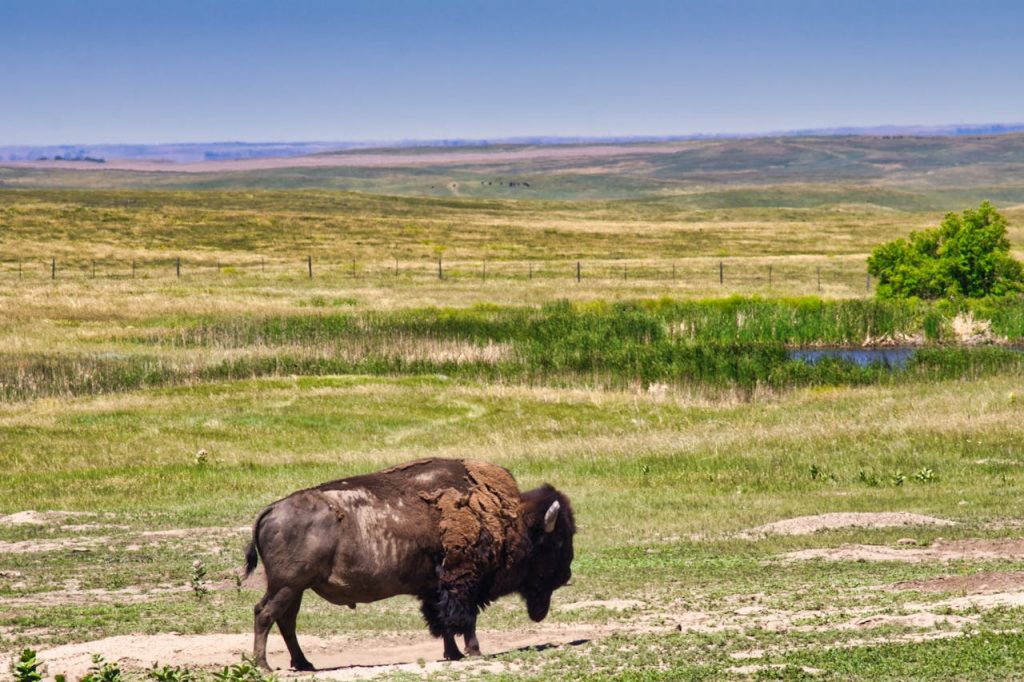
Maxwell Wildlife Refuge near Canton offers one of the clearest windows into Kansas prairie ecology. Public tram information describes guided rides of roughly 45 to 60 minutes across about 2,800 acres, with narration on grassland history, herd behavior, and habitat change over time. Bison are visible year-round, and elk are often easiest to spot from late fall through early spring.
The refuge rewards patience more than speed. Rolling ground, shifting weather, and long sightlines create a scene that feels both open and intimate, especially when herds move across the hills in silence. Scale and calm arrive together here.
Tallgrass Prairie National Preserve
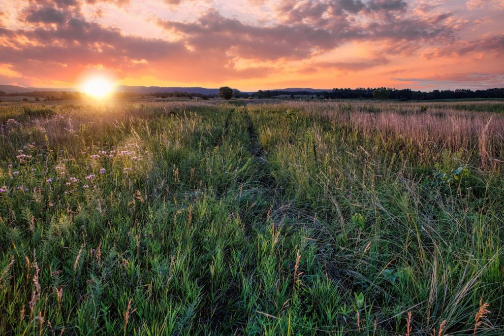
Tallgrass Prairie National Preserve protects one of North America’s rarest large ecosystems. National Park Service materials note that tallgrass prairie once stretched across roughly 170 million acres, while less than 4% remains today. In the Flint Hills, this preserve safeguards about 11,000 acres, plus historic ranch structures that tie ecological story to human settlement and grazing history.
More than 40 miles of trails cut through grasses that can rise above shoulder height by late summer. Bison on selected tracts, meadowlark calls, and wide evening light make the preserve feel expansive without ever feeling empty.
Rock City
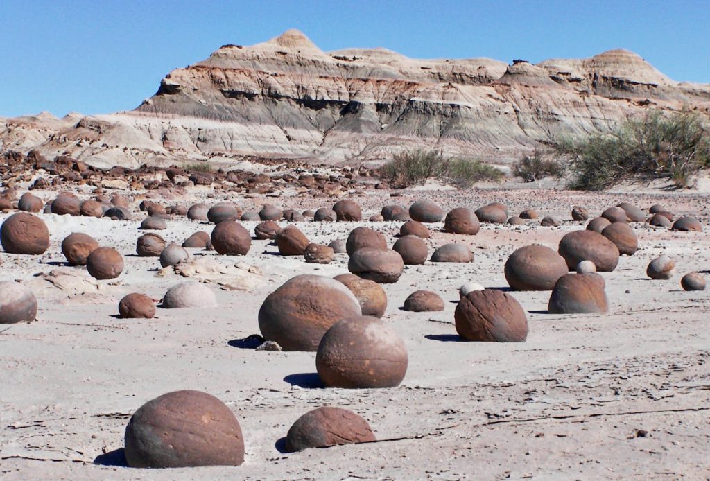
Rock City, near Minneapolis, Kansas, is playful geology at human scale. University of Kansas geology resources describe a field of large Dakota sandstone concretions, including spheres up to about 20 feet across, spread over an area roughly the size of two football fields. The scene looks improbable at first glance, then oddly natural once the eye settles into its patterns.
Unlike many fragile formations, this site is known for close interaction, with families often climbing and circling the stones from multiple angles. It is a short stop on paper, yet one that stays vivid long after the road turns east or west again.
The Flint Hills
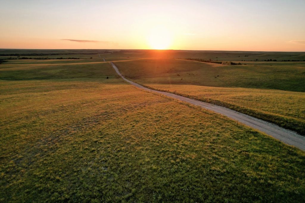
The Flint Hills are not a single attraction so much as a living region, defined by thin soils, exposed chert, and prairie that escaped the plow. Because cultivation was difficult here, the area still holds the largest remaining expanse of tallgrass prairie on Earth. Kansas routes like K-177 trace this terrain through long ridgelines, ranch country, and towns where land stewardship remains a daily practice.
Seasonal fire and regrowth shape the visual drama, from blackened spring slopes to summer green and autumn bronze. The effect is subtle, then overwhelming, and it gives eastern Kansas a signature no shortcut can replace.
Kansas keeps its strongest moments away from the loudest roads. In chalk, grass, and water, the state offers a quieter kind of wonder that rewards patience. Long after the trip ends, these corners tend to return first in memory.