

Wetlands are the planet’s quiet infrastructure, storing floodwater, filtering pollution, cooling coastlines, and feeding migrations that cross continents. Ecologists value them not only for beauty, but for the complex chemistry and life they hold together: peat that locks carbon away, mangroves that blunt storms, reed beds that cradle fish and birds. Many have been drained, dammed, or fragmented, which makes the intact ones feel almost unreal. These twelve wetlands stand out for scale, biodiversity, and the way water still dictates the rhythm of life there.
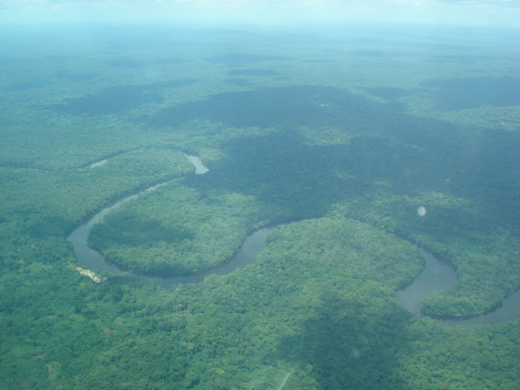
Okavango Delta, Botswana
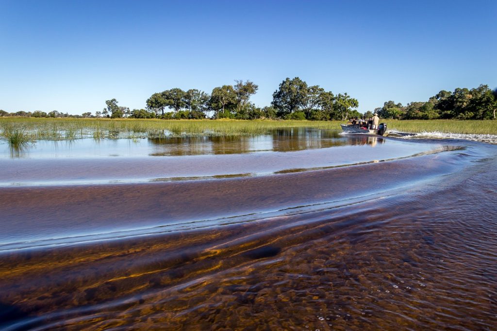
The Okavango is an inland delta that spills into Botswana’s Kalahari, turning the dry season into flood season and keeping permanent swamps beside broad, seasonal grasslands. UNESCO describes a vast wetland mosaic inside the World Heritage area, where shifting channels, islands, and lagoons create fresh edges for life as water spreads then recedes, with almost no slope to hurry it along. It stays remarkable because the annual flood pulse arrives like a clock yet never reaches the sea, making each year’s map look familiar and new at once, even within a single season by day too.
Pantanal, Brazil, Bolivia, And Paraguay
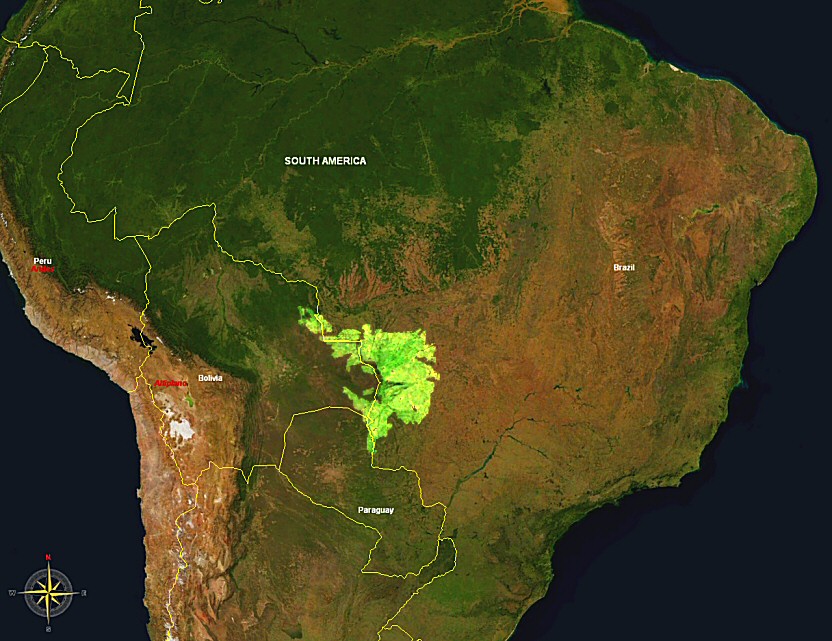
The Pantanal is often called the world’s largest tropical wetland, a floodplain where rivers spread and retreat, leaving open country that makes wildlife unusually visible. UNESCO’s Pantanal Conservation Area protects a core of this seasonal system, where floodwater renews grasslands, gallery forests and fish nurseries before draining back into the Paraguay River basin. It feels remarkable because the same water that sustains life also sets the rules: roads vanish, ranchland becomes lagoon, and each dry season concentrates animals along shrinking channels, while the next flood resets the board and redistributes everything again within weeks.
Sundarbans, Bangladesh And India
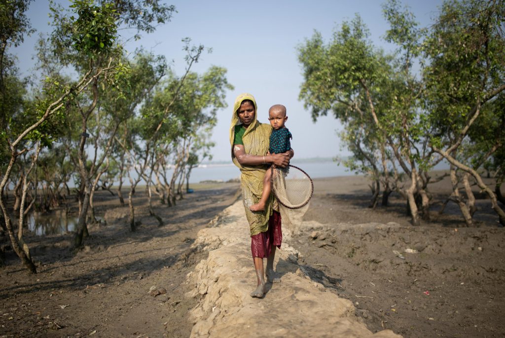
The Sundarbans sit on the Ganges-Brahmaputra-Meghna delta as one of the world’s largest mangrove forests, threaded by tidal waterways, mudflats, and shifting islands. UNESCO highlights a complex network of tidal channels and small islands of salt-tolerant trees, an example of ongoing coastal ecological processes where land and sea keep renegotiating space. It stays remarkable because it is both shield and nursery: storms break on living roots, fish and crabs feed economies, and the forest’s moving boundary forces every creature, including people, to adapt with the tide, day after day, as fresh water and salt water trade places across seasons.
Danube Delta, Romania And Ukraine
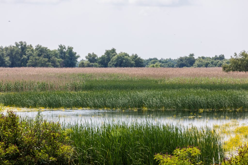
Where the Danube meets the Black Sea, it fans into Europe’s largest and best-preserved delta, a labyrinth of lakes, reed beds, and marshes. UNESCO notes over 300 bird species and 45 freshwater fish species in this wetland mosaic, which sits on a major flyway and supports fishing villages that still move by water. It feels remarkable because the delta is both vast and intimate: quiet channels open into wide sky, floating mats and willow fringes hide nesting colonies and reed seas soften sound and wind so a boat ride can pass from mirror-still lagoons to open marsh in minutes, with light changing on every bend, all in one delta each springtime.
Wadden Sea, Netherlands, Germany, And Denmark
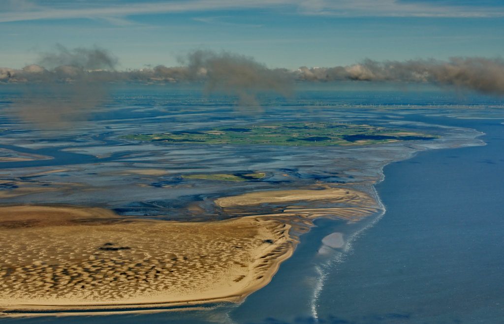
The Wadden Sea is the largest unbroken system of intertidal sand and mud flats in the world, UNESCO says, shaped by tides that expose and flood the seafloor twice daily. Those pulses feed dense beds of worms, shellfish, and tiny crustaceans, powering one of Earth’s great bird migrations as millions pause to refuel, then lift off along the same corridor. It is remarkable because it looks spare at first glance then reveals life everywhere underfoot, and the boundary between land and sea is rewritten each tide, making walking trails, boat channels, and feeding grounds appear and vanish on schedule, with natural processes largely undisturbed now.
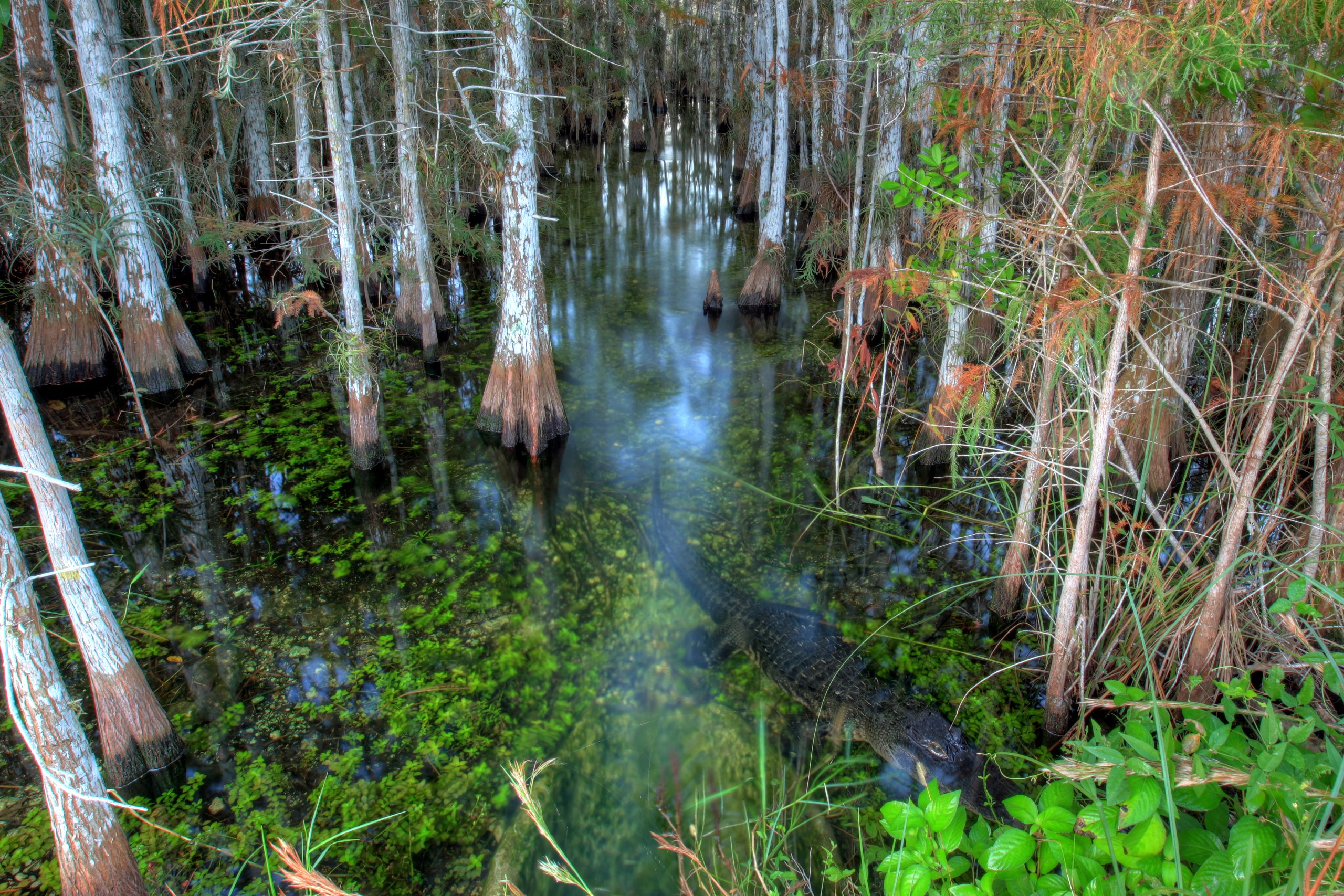
Everglades, United States
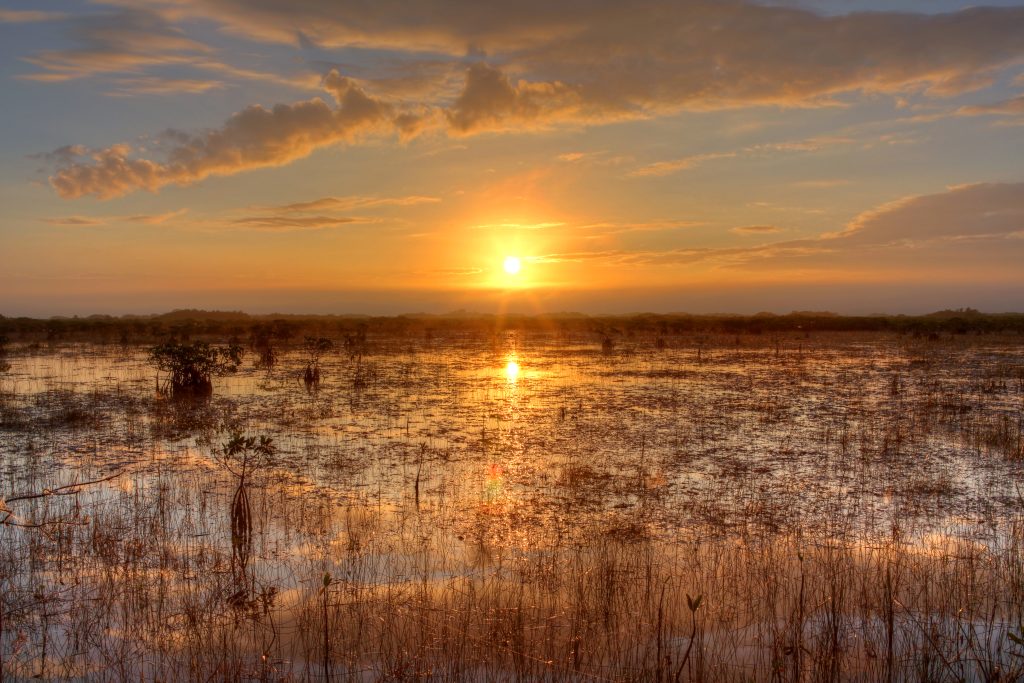
Everglades National Park protects a vast wetland where fresh water, brackish water, shallow bays, and coastal waters meet, creating a complex habitat mix, UNESCO notes. The sheet flow often called the River of Grass shapes tree islands, mangroves, and sawgrass plains, and small shifts in depth can decide nesting success, fish access, and fire risk. It stays remarkable because so few landscapes still run on water moving this gradually across flat ground, so recovery depends on timing and flow as much as volume, and the park’s future is tied to biodiversity and to the drinking-water system that serves South Florida far beyond the park boundary.
The Ahwar, Mesopotamian Marshes, Iraq
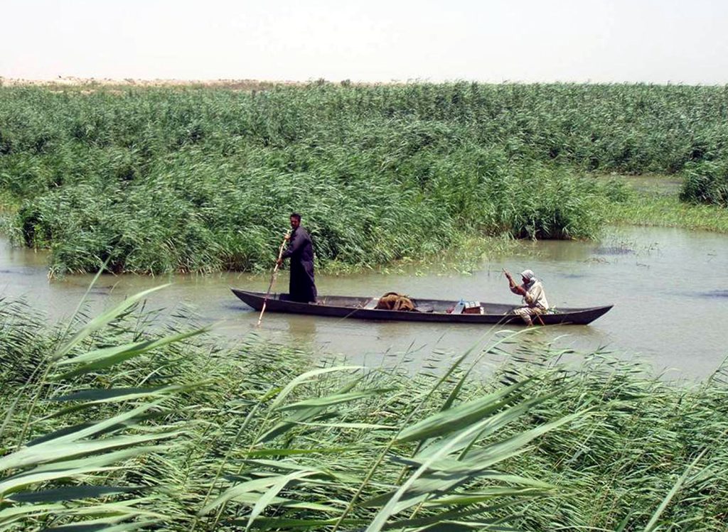
The Ahwar of southern Iraq, also called the Iraqi Marshlands, are one of the world’s largest inland delta systems in a hot, arid setting, UNESCO notes. Reed beds, open water, and river-fed marshes have supported biodiversity and a distinctive marsh culture for millennia, and UNESCO recognized the area as World Heritage in 2016 as a rare blend of nature and human history. It remains remarkable for resilience under pressure: when water returns, reeds and birds reappear quickly, but when it is withheld, the marsh contracts fast, leaving cracked basins and a reminder that recovery can be seasonal while loss can be permanent for entire communities.
Sudd, South Sudan
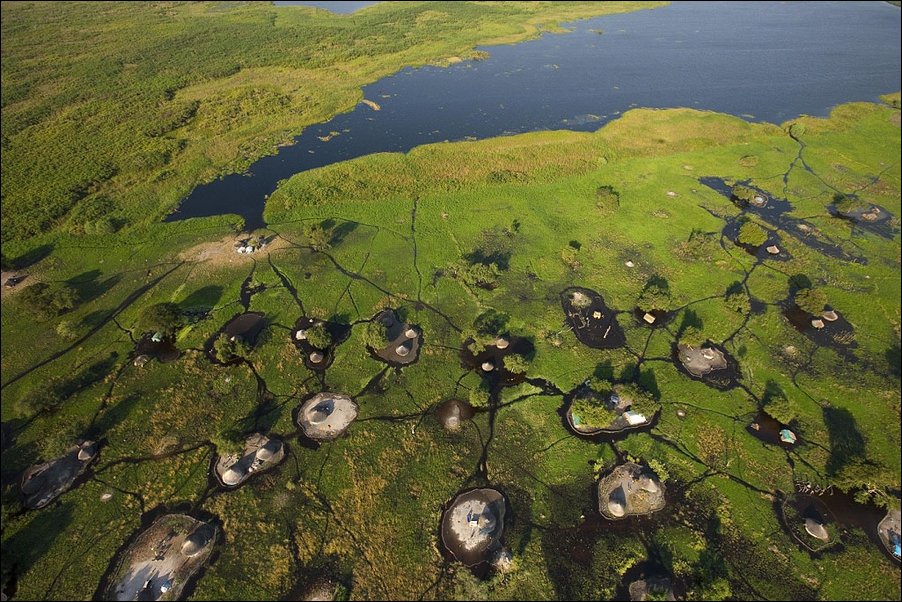
The Sudd is a vast White Nile wetland that expands and contracts with seasonal flows, forming floating vegetation mats that can block channels and redirect travel. UNESCO’s tentative description calls it Africa’s largest wetland and a giant sponge that regulates flooding and water quality, and it highlights the relationship between the wetland’s rhythms and local livelihoods. It stays remarkable because it is both ecosystem and climate engine: evaporation cools the region, papyrus and grasses slow water’s passage, and the landscape can look like open lake one month and thick green labyrinth the next, reshaping routes and ground as it spreads.
Kakadu Wetlands, Australia
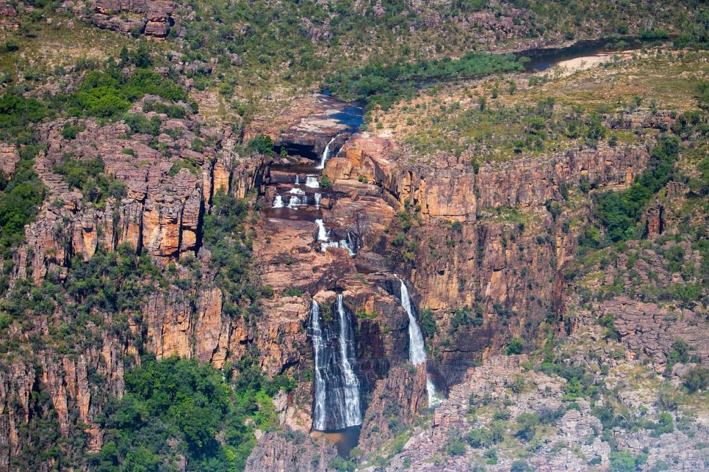
Kakadu’s northern floodplains stretch for tens of kilometers and UNESCO highlights the contrast between its Ramsar-listed wetlands and the park’s rugged escarpment. In the wet season, water spreads across paperbark swamps and billabongs then retreats, concentrating fish and drawing numbers of waterbirds into a shifting mosaic of lagoons and floodplain grasses. It feels remarkable because it is not one wetland but a sequence of them, timed to monsoon rhythms, with ancient rock art overlooking living water, and a landscape that can look like savanna one month and inland sea the next, so ecological change is visible without needing a microscope.
Tonle Sap Floodplain, Cambodia
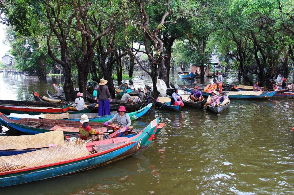
Tonle Sap’s flood pulse is dramatic: monsoon waters back up from the Mekong, expanding the lake into surrounding forests and floodplains, then draining away months later. UNESCO notes a complex delta-like system and habitats that support diverse species and it points out that a Ramsar site sits within the Tonle Sap Biosphere Reserve. It feels remarkable because productivity is born from motion, as fish breeding cycles track rising water, flooded forests feed the system, and seasonal change becomes a calendar for floating villages and farms that live with the shoreline moving in and out, turning dry-season paths into wet-season waterways, too.
Cuvette Centrale Peatlands, Congo Basin
In the central Congo Basin, scientists mapped the Cuvette Centrale peatlands in detail and showed they form the largest tropical peatland complex, storing immense carbon in waterlogged soils. A 2017 Nature paper explains how peat builds when organic matter accumulates under oxygen-poor, saturated conditions, creating a long-term carbon bank that depends on stable wetness. The place feels remarkable because it looks like ordinary swamp forest, yet its water chemistry holds global stakes, and drying it would unlock centuries of stored carbon, turning a hidden landscape into a climate problem that is hard to reverse once the peat oxidizes.
Doñana Wetlands, Spain
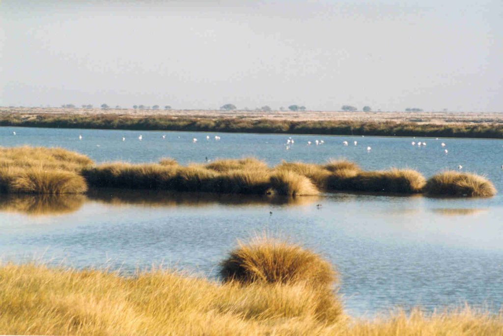
Doñana National Park sits at the Guadalquivir estuary in Andalusia and is notable for a mix of biotopes including lagoons and marshlands alongside dunes and Mediterranean scrub UNESCO notes. UNESCO also describes it as a major refuge for birds, including a wintering site for more than 500,000 waterfowl, which gives the wetlands a constant sense of motion from autumn through spring. It feels remarkable because water arrives in pulses: shallow ponds appear, disappear, and reappear, drawing migrants, predators and rare species, while farms and towns press close to the boundary, making every dry year a test of how much habitat can hold on, still.