

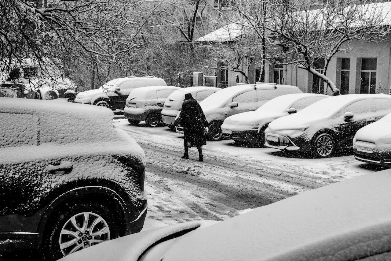
Along the Atlantic seaboard, winter storms rarely arrive with a single personality. They borrow warmth from the ocean, pull chill down from Canada, and let fast winds aloft stitch the whole thing together. The result is a map full of sharp edges: snow a few miles inland, sleet on the boundary, and cold rain at the shore.
Many setups begin as a low organizing near the Gulf of Mexico, then gaining strength as it angles toward the Northeast. From the southern Appalachians through the mid-Atlantic, the difference between plowable snow and a sloppy mix can be one late-night wobble in track or a thin layer of warm air sliding overhead.
Storm Track and Coastal Angle
Track decides who gets the cold side of the storm. A route inland tugs Atlantic air north and often turns coastal metros into rain or wet snow that compacts fast, even while nearby suburbs are sliding into sleet.
A path closer to the shoreline can keep colder air pinned west of the center, stacking steadier snow across the interior and the higher ridges. Because the transition zone hugs I-95 from the mid-Atlantic into the Northeast, a small shift in angle, or speed, can move the dividing line by counties, not states, and morning totals can look nothing like late-night expectations for roads and airports. All at once.
Gulf Moisture and Intensification
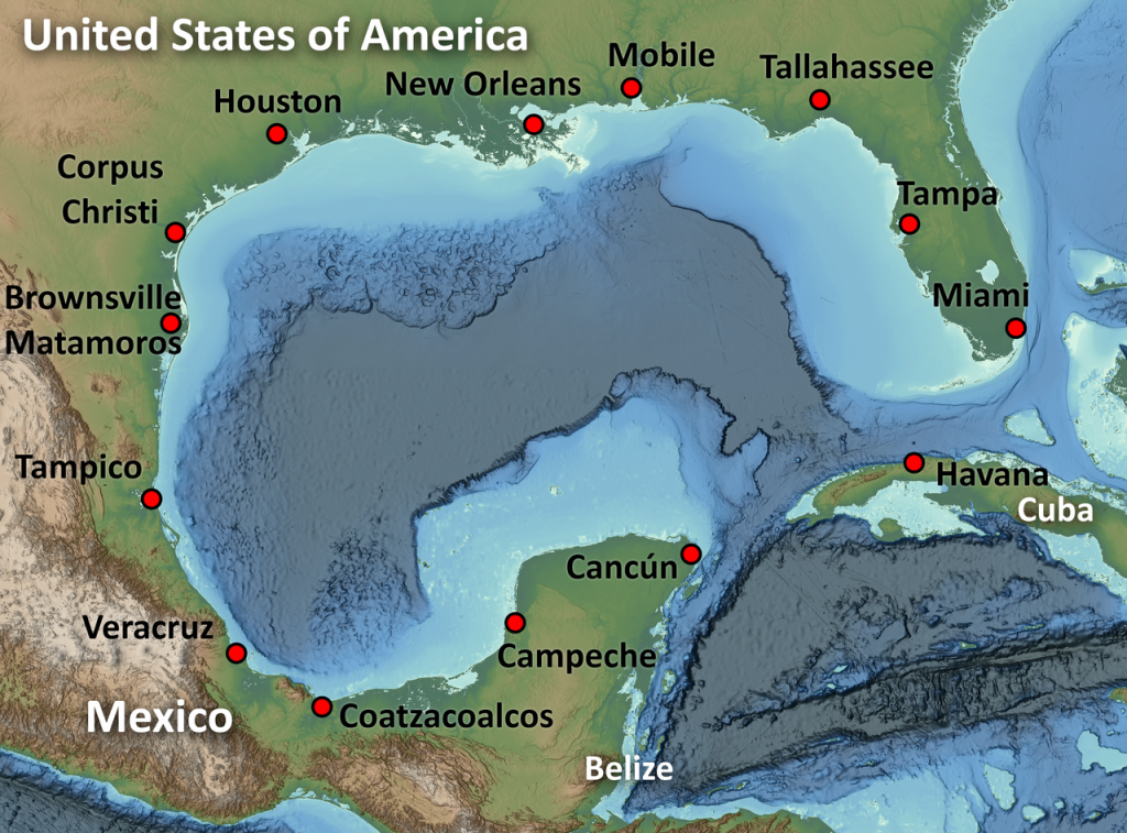
Many East Coast storms load up over the Gulf of Mexico, where warm water and humid air feed a growing low. That moisture streams north on a broad conveyor, widening the shield of precipitation from the Southeast into the mid-Atlantic long before the center arrives.
If pressure falls quickly as the system turns northeast, the storm can tighten into heavier bands and stronger winds, and precipitation rates spike. When that deepening lines up with colder air, snow expands inland and can pile up fast; when it lags, warmer air slips in near the coast, and the same moisture lands as rain or a dense, slushy mix that is hard to clear.
Cold Air Supply and Damming

Cold air has to arrive on time, and it has to hold its ground. A strong high to the north can push dense air southward, and that wedge can get trapped against the eastern slopes of the Appalachians when surface winds stay northeast.
That cold-air damming keeps surface temperatures below freezing even when milder air rides overhead, which is why sleet and freezing rain show up so often in the mid-Atlantic. The cold layer can be shallow, stubborn, and oddly local, lingering in valleys after sunset. As the storm strengthens, winds aloft can eat into the wedge, and the precipitation type can change fast. Near daybreak in spots.
Jet Stream Timing and Phasing

High above the clouds, the jet stream sets the schedule. It steers the storm, but it also controls how much lift the system can create, which is what turns scattered showers into a sprawling shield from the Carolinas to New England.
When energy in the southern branch links up with a northern disturbance, the atmosphere can phase and deepen the surface low more quickly. That added support aloft boosts rising motion, tightens the wind field, and helps organize narrow, intense bands. If the timing slips by even a few hours, the storm stays flatter, warmer air noses inland, and snow coverage shrinks to the higher terrain.
The Warm Nose Aloft

Precipitation type is decided by the whole temperature profile, not a single reading at street level. A common East Coast spoiler is a warm nose, a layer a few thousand feet up that rises above freezing while the surface stays cold. It often arrives ahead of a strong coastal low.
In that setup, snow melts into raindrops aloft. If the cold layer below is deep, the drops refreeze into sleet before reaching the ground; if it is thin, they stay liquid and freeze on contact, coating trees, wires, and sidewalks. The warm nose can drift with the storm’s track, so the line between sleet and snow can slide across neighborhoods overnight.
Surface and Ground Temperature

Air temperature gets the headlines, but pavement and low-level moisture do much of the deciding. A mild stretch can leave roads warm enough to erase early flakes, especially in daylight and in dense city blocks.
A colder base changes the math, letting snow stick quickly at night on bridges and untreated streets. Coastal influence adds another twist: marine air can keep shore towns closer to rain while inland neighborhoods cool faster and hold snow. Dew points matter because drier air can cool the surface layer as precipitation starts, nudging the changeover line a few miles. That is why radar alone can mislead. At times.
Precipitation Rate and Cooling
Rate can change the outcome when temperatures hover near freezing. Heavy precipitation cools the air column through evaporation and melting, sometimes dragging the rain-snow line south, or closer to the coast, for a few hours even without a major track shift.
That is why a place can go from wet streets to plowable snow during one intense band, then slide back to sleet or rain when rates relax. Dynamic cooling is not magic; it is physics moving heat around and changing the vertical profile. In marginal setups, it can separate a quick coating from several inches, especially on the inland side of a coastal front near midnight.
Coastal Fronts and Snow Bands
Near the shoreline, storms often build a coastal front, a narrow boundary where chilly inland air meets milder marine air. The temperature contrast tightens, lift focuses, and precipitation organizes into narrow bands.
Those bands can produce intense snowfall rates just west of the rain line, while a town closer to the water stays in cold rain. The front can wobble with wind shifts and pressure falls, so the heaviest burst may last only an hour or two, yet it drives most of the accumulation and the worst travel. Radar may show a clean comma shape, but the real story is often this thin, moving boundary. It keeps planners humble.
Terrain and Microclimates

Topography quietly tilts the odds. The Appalachians lift moist air and cool it, boosting snow on higher ridges while nearby valleys mix longer, and cold air can drain into sheltered hollows after sunset.
Farther north, interior elevations in the Poconos, Catskills, and Berkshires often stay colder than coastal cities, so snow ratios improve and totals climb. Urban heat islands push the other way, keeping downtown pavement a degree warmer than nearby suburbs. In a tight transition zone, that small difference decides whether snow sticks, melts, or turns to slush at the peak. Onshore wind can warm the coastal plain quickly.
East Coast winter storms feel unpredictable because the atmosphere stacks small advantages and small mistakes. A slight track change, a thin warm layer aloft, or one intense band can decide whether precipitation falls as snow, ice, or rain. That mix is frustrating, but it also explains why careful forecasts focus on layers, timing, and local terrain, not just a single temperature on a phone screen.